Skip to main content
Some Facts
- Guyana means Land of Many Waters
- Is located between 1 and 9 degrees latitude and 57 and 61 degrees longitude
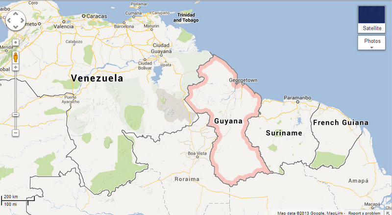
- Bordered by Venezuela, Suriname, and Brazil
- Three major rivers - Essequibo (has islands!), Demarara, and Berbice.
- Guyana is one of the poorest countries in the Western Hemisphere, second only to Haiti (I didn't realize that!)
- Exodus of Guyanese has resulted in significant brain drain.
- Population of Guyana (http://www.statisticsguyana.gov.gy/census.html; 2002) is about 750,000 of which about 239,000 live in Georgetown, the capital.
- Most of the population lives along the coast.
- Ethnic groups: East Indian (43.5%); persons of African heritage (30.2%), Mixed heritage (16.7%), Amerindian (9.2%); a very small percentage of "Whites", Portuguese, and Chinese
- Major Guyana's newspapers include:
- It rains a lot. Rainy season is from May to June and from December to end of January. Rain comes down in heavy bursts in typical tropical style.
- Water for drinking is best boiled or 5 gal water containers can be obtained for pretty cheap
- Electricity and plugs format in urban areas is similar to that of Canada and the US - 110 volts
- Cell phones: Digicel and Guyana Telephone and Telegraph Company (GT&T). Cuso and VSO expats are generally on Digicel (cheaper to call on the same network)

Comments